Studi Seismik Hazard dan Analisis Risiko dengan Pendekatan Probabilitas di Pulau Jawa.
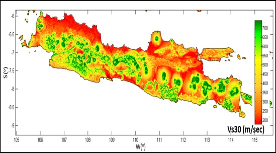
The island of Java is within the Indonesian Archipelago, above the Eurasian Plate by the northern thrust of the Australian Plate beneath the Eurasian Plate. The subduction convergence forms an orthogonal angle to the trough along the southern island of Java. In earthquake disasters caused by plate subduction, studies and evaluations of the dangers and risks of earthquakes need to be carried out. One method for analyzing the probability of earthquake risk is to conduct a seismic hazard study. The study of seismic hazard was carried out using a probability approach using the event based approach method. This means that ground motion is calculated on an event-by-event basis and the results are aggregated separately to form a probability estimate. The event based approach method is different from the PSHA approach which integrates all combinations of size and distance. This research presents site classification (soil type) for Java Island using shear wave velocity at a depth of 30 m (Vs30) from USGS data. Next, a seismic hazard probability risk analysis was carried out to map the seismic hazard in terms of maximum ground acceleration in bedrock and surface rock by considering site classification. Based on potential earthquake sources, earthquake history, geological conditions, and vulnerability curves, a risk model for the island of Java can be drawn.


